


FSAV - Flight Situational Awareness Viewer app for iPhone and iPad
Developer: Basic Commerce & Industries, Inc
First release : 13 May 2014
App size: 9.03 Mb
FSAV provides better situational awareness for flight planning by providing weather products such as turbulence, icing, and radar reflectivity along with aeronautical charts and navaids.
Features:
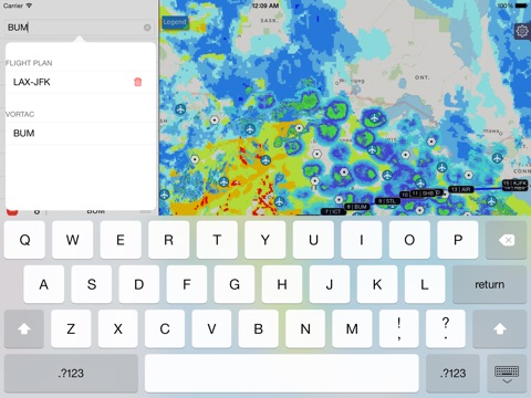
- Flight path planning tool
-- Plot flight path via map and/or text input
-- Manipulation of the flight path for adaptability
-- Save and load favorite flight path
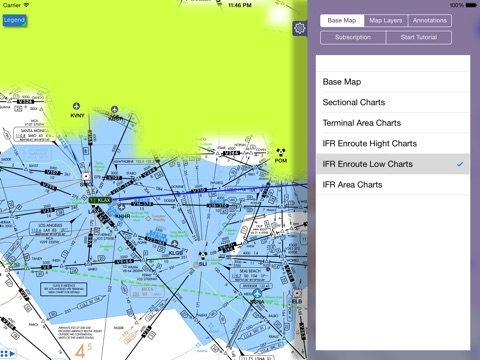
- Viewable aeronautical charts:
-- Sectional charts
-- Terminal area charts
-- IFR enroute high and low charts
-- IFR area charts
- Selectable navigational aid: airports, VOR, VOR-DME, VORTAC
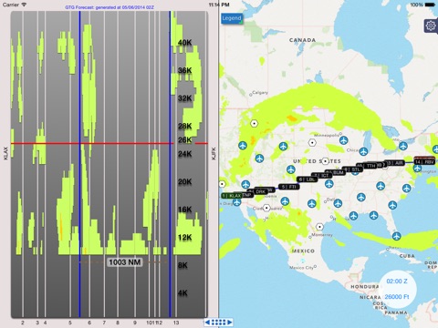
- Unique vertical cross section views depicting a weather product along a plotted flight path
- Traditional top down view of weather products
- Weather products *
-- Includes Graphical Turbulence Guidance (GTG) forecast
-- Includes Current Icing Product - severity (CIP) / Forecast Icing Product - severity (FIP)
-- Includes NEXRAD base reflectivity **
-- Up to 8 hrs of forecast with 1 hr increments ***
-- With 2 hrs of historical data
-- Altitude slices of 1000 ft increments from 1,000 ft and up to 44,000 ft in elevation
* Coverage is only available for the Continental United States only
** Only available for current time
*** Availability depends on subscription
Optional Non-Renewing In-App Subscriptions
- 1 month of GTG and CIP/FIP forecast/nowcast data
- 1 year of GTG and CIP/FIP forecast/nowcast data
Subscriptions are managed through the in app settings panel. Once a subscription has expired, you will be prompted to renew / purchase a new subscription.
We are looking to improve upon this application and provide additional weather products package(s) and improvements in the near future. So please look forward to it.
Note: Internet connection is required
Disclaimer: We accept no responsibility for any loss or damage caused by the use of this software. You use all the information at your own risk.